en English
Untitled English subtitles
Report a problem
Advertisement
English transcript
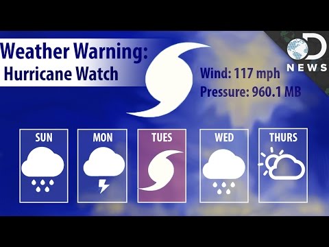
One of DNews' camerapeeps is going to the Caribbean, even though she KNOWS a hurricane
is bearing down right now! How do we know storms are going to hit so far in advance?
Hope it doesn't ruin your vacay, Liz!
From a scientific perspective, hurricanes are amazing to behold. They're raw, powerful
nature in all its destructive glory. But humanity's constructions and alterations to our environment
don't hold up well to hundred-mile-per-hour winds or the sea's violent encroachment onto
the shore.
Hurricanes form when warm, moist tropical air rises, letting cooler air fall into the
now-low pressure area below. As that heats, it rises too, letting more cool air move in...
Over time, this causes a cycling, swirling mass of air, pressure and wind that speeds
up before being thrown away from the tropics, sometimes in the direction of land. Category
5 hurricanes, the most powerful storm on Earth, can create 155 mph (250kph) winds and 19 plus
foot (5.8M) surges of water called storm surge.
Needless to say, it helps to know they're coming so we can hightail it out of the way.
In 1937, a surprise hurricane hit New England and killed 600 people. Before we could predict
them, we had to learn how they formed and how to track them. In the earliest days of
hurricane prediction, the best we could do was fly out and meet it. Pilots literally
flew toward a storm to learn more about them! We've been flying INTO HURRICANES since 1943,
when members of the Army Air Corps flew into a hurricane off the coast of Texas sporting
132 mph winds (212kph). These brave men learned about how hurricane air temperature changes
from the edge of the storm moving to the interior; and were able to track the storm on a path,
laying a foundation for the first hurricane warning predictions. A year later, in 1944,
pilots were able to get warning to New England and only 50 were killed when a hurricane struck.
Hurricane prediction can save hundreds of lives!
Now in the 21st century… with all this technology around us… we're still flying into storms.
IT'S STILL ONE OF THE BEST WAYS TO LEARN ABOUT THEM! The Hurricane Hunters are part of the
53rd Weather Reconnaissance Squadron/403rd Wing and they are the "only operational unit
in the world flying weather reconnaissance on a routine basis." They provide surveillance
of tropical storms and hurricanes all over the world and deliver that information to
the World Meteorological Association's Miami Regional Specialized Meteorological Center
or RSMC. Today, the planes are equipped with more than just thermometers… they have data-gathering
tools to map winds and formations, and planes deploy "Dropwindsondes" throughout the storms…
Dropwindsondes are expendable parachuted cylinders that measure "temperature, pressure, winds,
and humidity every half-second." That information is supported by satellites from NASA, ocean
buoys from NOAA and ground stations and monitoring platforms spread across the Earth's continents,
island and oceans. All the data is relayed to the RSMCs in Miami, Honolulu, New Delhi,
Tokyo, Nadi in the Pacific and La Réunion (off the coast of Madagascar). RSMCs are the
front line for informing the public about any coming storms, but first, we have to know
what we're dealing with.
Once they have the data, scientists plug it into constantly revised and updated computer
models. NOAA the National Oceanic and Atmospheric Administration has two supercomputers that
only run simulations of storms. These computer models churn through all the new data and
all past data to render the storms in 3D and predict where they'll go and how strong they'll
be. Like with any science, as more data is gathered, the predictions get more accurate.
But even still, hurricane prediction is not an exact science. Since 2003, predictions
on hurricanes in the U.S. have been delivered 120 hours before landfall, 96 hours before,
72, 48, 24, and 12. At 120 hours before landfall (or five days out), the margin of error for
where the storm will actually hit can be 350 MILES (563km) off! 350 mile margin of error
means they could evacuate New Orleans, only to have the hurricane smack into Pensacola,
Florida or East Texas! That's a big difference. By the last 24 hours, they've got it down
to 100 mile error margin (160km) or less. Predictions get more accurate as the hurricane
gets closer, and more data is collected, but bad predictions severely affect residents
being forced to evacuate, and can cost lives, and money.
The reason it's so hard, is because data can be flawed or incomplete, the flights couldn't
get to where the meteorologists needed, ocean monitoring buoys could be damaged, or a ground
station might be! And still, sometimes, the satellites aren't good enough, or the computer
models just aren't accurate enough. It's a constant battle to make prediction better,
and to add to the arsenal NASA is launching eight microsatellites to track global hurricanes
and forecast their movements. CYGNSS or the Cyclone Global Navigation Satellite System
will work together, and with GPS satellites, to measure winds and waves on the ocean surface,
as well as surface and cloud temperatures, heat radiation, ocean roughness and hurricane
intensity, and also how temperatures move WITHIN storms (called convective dynamics)
-- just like those 1940s pilots. CYGNSS will be ready before the 2017 hurricane season,
which is good, because Earth's hurricanes seem to be intensifying and becoming more
common; so every little bit helps.
Thanks to this vast network of collaborating applied sciences, we know a hurricane is coming
many days in advance! Which is a huge leap in only 70 years. Thanks to these systems,
scientists can monitor and inform the public about every tropical cyclone, hurricane, and
typhoon anywhere in the world.
is bearing down right now! How do we know storms are going to hit so far in advance?
Hope it doesn't ruin your vacay, Liz!
From a scientific perspective, hurricanes are amazing to behold. They're raw, powerful
nature in all its destructive glory. But humanity's constructions and alterations to our environment
don't hold up well to hundred-mile-per-hour winds or the sea's violent encroachment onto
the shore.
Hurricanes form when warm, moist tropical air rises, letting cooler air fall into the
now-low pressure area below. As that heats, it rises too, letting more cool air move in...
Over time, this causes a cycling, swirling mass of air, pressure and wind that speeds
up before being thrown away from the tropics, sometimes in the direction of land. Category
5 hurricanes, the most powerful storm on Earth, can create 155 mph (250kph) winds and 19 plus
foot (5.8M) surges of water called storm surge.
Needless to say, it helps to know they're coming so we can hightail it out of the way.
In 1937, a surprise hurricane hit New England and killed 600 people. Before we could predict
them, we had to learn how they formed and how to track them. In the earliest days of
hurricane prediction, the best we could do was fly out and meet it. Pilots literally
flew toward a storm to learn more about them! We've been flying INTO HURRICANES since 1943,
when members of the Army Air Corps flew into a hurricane off the coast of Texas sporting
132 mph winds (212kph). These brave men learned about how hurricane air temperature changes
from the edge of the storm moving to the interior; and were able to track the storm on a path,
laying a foundation for the first hurricane warning predictions. A year later, in 1944,
pilots were able to get warning to New England and only 50 were killed when a hurricane struck.
Hurricane prediction can save hundreds of lives!
Now in the 21st century… with all this technology around us… we're still flying into storms.
IT'S STILL ONE OF THE BEST WAYS TO LEARN ABOUT THEM! The Hurricane Hunters are part of the
53rd Weather Reconnaissance Squadron/403rd Wing and they are the "only operational unit
in the world flying weather reconnaissance on a routine basis." They provide surveillance
of tropical storms and hurricanes all over the world and deliver that information to
the World Meteorological Association's Miami Regional Specialized Meteorological Center
or RSMC. Today, the planes are equipped with more than just thermometers… they have data-gathering
tools to map winds and formations, and planes deploy "Dropwindsondes" throughout the storms…
Dropwindsondes are expendable parachuted cylinders that measure "temperature, pressure, winds,
and humidity every half-second." That information is supported by satellites from NASA, ocean
buoys from NOAA and ground stations and monitoring platforms spread across the Earth's continents,
island and oceans. All the data is relayed to the RSMCs in Miami, Honolulu, New Delhi,
Tokyo, Nadi in the Pacific and La Réunion (off the coast of Madagascar). RSMCs are the
front line for informing the public about any coming storms, but first, we have to know
what we're dealing with.
Once they have the data, scientists plug it into constantly revised and updated computer
models. NOAA the National Oceanic and Atmospheric Administration has two supercomputers that
only run simulations of storms. These computer models churn through all the new data and
all past data to render the storms in 3D and predict where they'll go and how strong they'll
be. Like with any science, as more data is gathered, the predictions get more accurate.
But even still, hurricane prediction is not an exact science. Since 2003, predictions
on hurricanes in the U.S. have been delivered 120 hours before landfall, 96 hours before,
72, 48, 24, and 12. At 120 hours before landfall (or five days out), the margin of error for
where the storm will actually hit can be 350 MILES (563km) off! 350 mile margin of error
means they could evacuate New Orleans, only to have the hurricane smack into Pensacola,
Florida or East Texas! That's a big difference. By the last 24 hours, they've got it down
to 100 mile error margin (160km) or less. Predictions get more accurate as the hurricane
gets closer, and more data is collected, but bad predictions severely affect residents
being forced to evacuate, and can cost lives, and money.
The reason it's so hard, is because data can be flawed or incomplete, the flights couldn't
get to where the meteorologists needed, ocean monitoring buoys could be damaged, or a ground
station might be! And still, sometimes, the satellites aren't good enough, or the computer
models just aren't accurate enough. It's a constant battle to make prediction better,
and to add to the arsenal NASA is launching eight microsatellites to track global hurricanes
and forecast their movements. CYGNSS or the Cyclone Global Navigation Satellite System
will work together, and with GPS satellites, to measure winds and waves on the ocean surface,
as well as surface and cloud temperatures, heat radiation, ocean roughness and hurricane
intensity, and also how temperatures move WITHIN storms (called convective dynamics)
-- just like those 1940s pilots. CYGNSS will be ready before the 2017 hurricane season,
which is good, because Earth's hurricanes seem to be intensifying and becoming more
common; so every little bit helps.
Thanks to this vast network of collaborating applied sciences, we know a hurricane is coming
many days in advance! Which is a huge leap in only 70 years. Thanks to these systems,
scientists can monitor and inform the public about every tropical cyclone, hurricane, and
typhoon anywhere in the world.